Marriots Way is a fantastic footpath running along an old railway line about 26 miles between Alysham and Norwich. There are lots of places to access it from along the route and a great walk to explore nature, watch the changing seasons and tire little ones out. By my understanding some of the route is easier going for buggies, bikes, scooters etc so it’s best to check the Marriots Way website for advise. I’ll also keep note of conditions on the blog as we explore sections of it.
Today we visited Whitwell Station near Reepham where part of the Marriots way footpath can be accessed from. Whitwell Station is a really friendly working heritage station with excellent free parking, great toilets and a lovely cafe. It’s a friendly place and the team who run it are really helpful, you only have to ask to access the baby changing facilities.
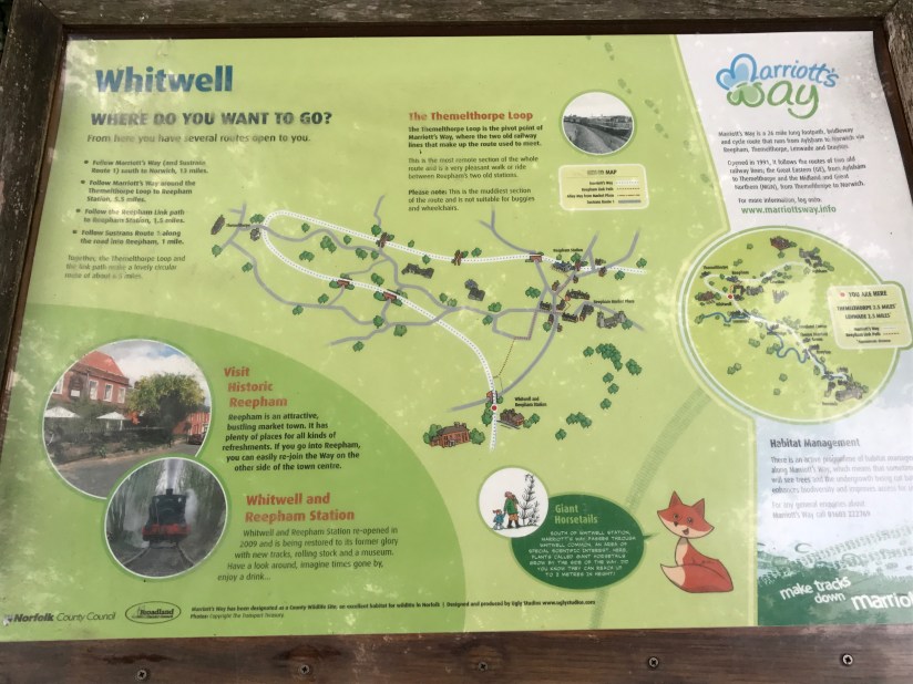
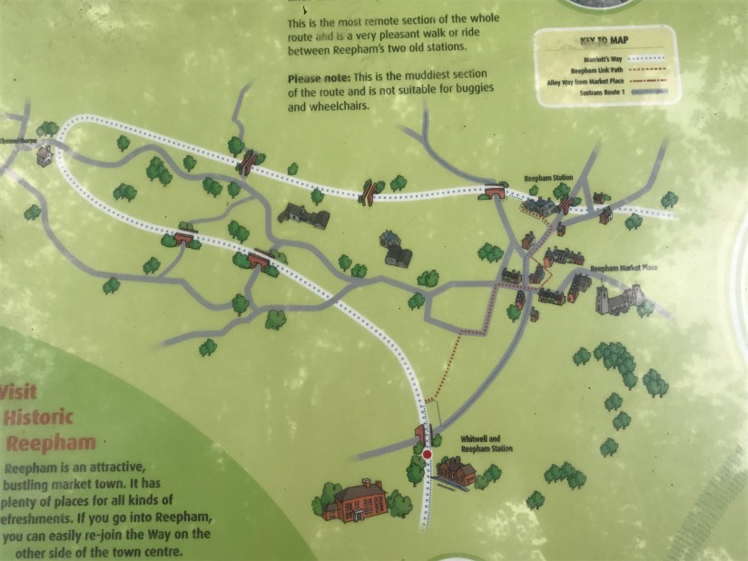
I’ve included a couple of photos I took of the footpath map which goes to the right of the station and can be accessed via the station platform. This forms a loop and runs just over six miles to Reepham Station (now disused as a station but has a cafe). It’s worth noting it does suggest that this route can be muddy and not suitable for buggies so today we walked a couple of miles in the opposite direction to this. The route would eventually take you to Drayton which is 9.5 miles if you were feeling energetic! The path is really flat and is excellent for both buggies and scooters as you can see from my photos below.


There are lots of bridges and points of interest along the way. We loved collecting sticks and playing ‘pooh sticks’ at one of the bridges, we also spotted a frog, some sheep, saw lots of people on bikes, walking dogs and followed some horse shoe shaped tracks.
Do take a look at the Marriots Way free download with everything in you need to know about the walks. I’ve taken a look at it this evening and will definitely be using this to help me plan future days out. The section on part of the walk we did today is on Page 24.
